
GARMONT EXPERIENCE
DISTANCE
52 km
DAYS
2
HIGH POINT
2,200 Mt
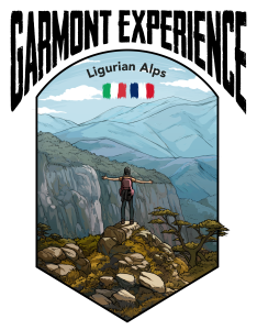

From the highest peak in Liguria to the sea
From Mount Saccarello to Rocchetta Nervina.
Nine trekkers, plenty of fresh air, a refuge, a night in a tent, stars and over 50 km in 48 hours. This is how one can sum up the first Garmont Experience of Trip in Your Shoes. It was a need to get away for a couple of days from the hustle and bustle of the city, to dip mind and body into a two-day adventure. Of course, there was no lack of fatigue, commitment and sweat, but after all, we had set out with quite clear intentions.
The starting point for this expedition, accomplished in the middle of Autumn, was Rifugio Laterza, not far from Monte Saccarello, which with its 2200 metres above sea level is the highest peak in Liguria. We spent our first night there, and from there our trek began, well before sunrise.
After setting the alarm clock at 4.30 a.m., we tied our hiking shoes, packed our backpacks and turned on our torches, ready to start a trek that should not be underestimated for its landscape and natural beauty.

")
")
The first stage, just over 30 km, gave us the chance to discover an Alpine stretch rich in nature and history
Walking with darkness around us, the beam of torches in front of our steps, the heavy breathing and the damp cold that precedes the dawn, is an experience that reconnects you with life. We should all get used to experiencing authentic and genuine moments like this more often. Early sleep soon gave way to adrenalin and energy in the first two hours, which passed at a very fast rhythm, with several kilometres completed at great speed.
From Saccarello, the first descent was dry and very steep.
But it was with the start of the climb that we were surprised by the sunrise: an indescribable emotion. Around us the world still seemed completely asleep, shrouded in a soft light. The view ranged from the mountains to the Mediterranean Sea, even to Corsica, whose mountain profiles could be glimpsed.
The necessary rest, however, soon had to give way to concentration as we took a dirt road that led us rather gently to the old barracks of Cima Marta. They are located just below the homonymous summit and have served as military support structures since the 18th century.
The landscape here is rather verdant, with meadows and pastures that are active even during Autumn.
Il Sentiero degli Alpini: a rare gem
The central part of the stage was more challenging, with an exposed and extremely panoramic part known as “Il Sentiero degli Alpini”. This is a walkway ‘built’ on rock faces, which became strategically important during the two World Wars, both in the 15-18 period and during the Second World War. Being close to the French-Italian border, fortifications and routes for the units’ movement were built here on several occasions.
Today, walking through this territory also means breathing history.
Hiking in an interesting morphological context such as the one at Monte Toraggio (1973 m.a.s.l.) is for sure a plus. In terms of the difficulty of the itinerary, we should mention the climb required to reach the Passo dell’Incisa (1684 metres), where we stopped for lunch.


")
The second stage: twenty kilometres to Rocchetta Nervina and its small lakes
Day two, considering the efforts we had undergone the previous day, began with a slightly calmer, even though it was early morning. For the whole first part of the day, the route followed a dirt road, which took us through colourful forests, spread pastures and spots where we could admire the entire valley.
We reached Gouta, where we stopped for a short recovery rest, before heading towards the small lakes of Rocchetta. These are a series of very interesting pools of water, originating from the Barbaira stream in the upper Nervia Valley.
Approaching the watercourse should not be underestimated, especially in terms of kilometric distance and time required: in fact, it took us the whole morning to reach the hollow. This, near Rocchetta Nervina, turns into a sort of canyon, which can be enjoyed for large tracts. You can take a regenerating swim in the pools during the warm season. The water temperature in early November, as in our case, was particularly cold.
We could not enjoy the final stage, flat and panoramic, due to the fatigue we had accumulated over the two days of hiking and the several hours of walking.
Last but not least, Rocchetta Nervina, the final stage of our excursion.
This is a rather little-known village nestled in the mountains of extreme western Liguria. It has just less than three hundred inhabitants, but during weekends it populates with trekkers and nature lovers, thanks to the wide range of trails behind it. The houses are located around the Barbaira stream and give the village an elegant atmosphere, without losing its medieval origins.
In terms of footwear, we recommend wearing mountain boots, but trekking shoes are even better, as the route is hard-packed (with dirt tracks and long, flat distances).
We slept in the Rifugio Laterza for the first night, before our departure, while on the second day we placed our tents. There are not many suitable places to pitch them, so we recommend relying on maps and common sense. We camped in the Scarassan meadows.
It is essential to have your own camping stove for this trek, so that you can be completely self-sufficient with your meals. We mention Fonte S. Martino, which flows directly from the rock, and recommend refuelling near Gouta.